Active Tentative Map
City of North Las Vegas
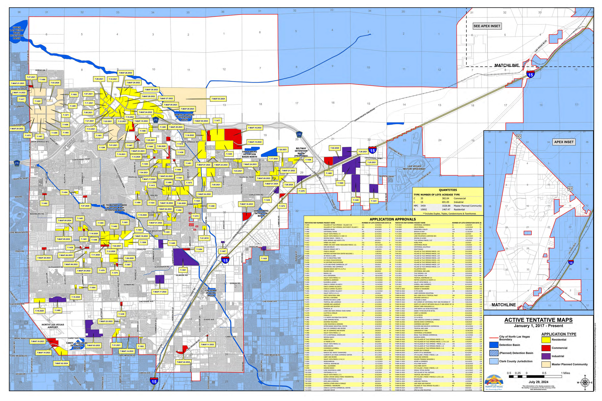
This is a map I’m particularly proud of. As part of the early stages for developers in obtaining permission to start construction, they needed to procure an active tentative map, which shows the area where the construction would be going to take place, what kind of construction it would be, and when the developers needed to finish the project by.
When I was first assigned to this map, the labels were shapes that were drawn onto the layout, not actually tied to any data. The quantities table and application approvals table also needed to be updated by hand. I made it so that when a new active tentative map needed to be added, as soon it was drawn and the attributes were filled out, it would create a new label and update the application approvals table automatically. Once all the drawings were made, I programmed a tool to re-calculate the quantities table. I did this all while maintaining the original style of the map that the department approved.
Click me to see full map!